 |
||
| Home Calendar Directions Rehearsals About the Band Gallery Donations Contact Us | ||
|
Directions (from Google Maps) and Locations The Village School 100 West Prospect Street, Waldwick, NJ 07463 off Hopper Avenue and across from the Waldwick Amphitheatre Lots of free parking, theater-style seats in an auditorium. Click here for Directions 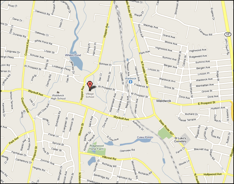
Lots of free parking,
theater-style
seats in an auditorium.
From the south on Route 17:
Hollywood Avenue exit; left turn back over Route 17. Through the
light,then to the top of the hill (flashing light). Turn right onto
Franklin Turnpike. Left at the next light, onto Wyckoff Avenue. Right
on Hopper Avenue. There is an entrance to the school (long ramp) on the
right. There's also an
entrance on West Prospect.From the north on Route 17: Waldwick/Ho-Ho-Kus exit (Sherman Ave./Prospect Street) onto Prospect Street. At next light, turn left onto Franklin Turnpike, then a block later, at the next light, right onto Wyckoff Avenue. Then follow the directions above. From Ridgewood: Maple Avenue north into downtown Ho-Ho-Kus, where it becomes (more or less) Franklin Turnpike. Go past the Hermitage to Wyckoff Avenue (traffic light). Turn left. (Turn right and you will destroy a hardware store.) At the second light, turn right onto Hopper Avenue. There is an entrance to the school before the next intersection. From Allendale: Go south on Crescent Avenue, past the Crescent School (our old location). Turn left onto Wyckoff Avenue. Go past the high school, turn left at the Hopper Avenue light. Or, from Crescent Avenue, you can turn left onto Prospect Street, and take that to the Village School. Waldwick Pool Parking Lot
44 Hopper Avenue, Waldwick, NJ -- at intersection with West Prospect Avenue Click here for Directions 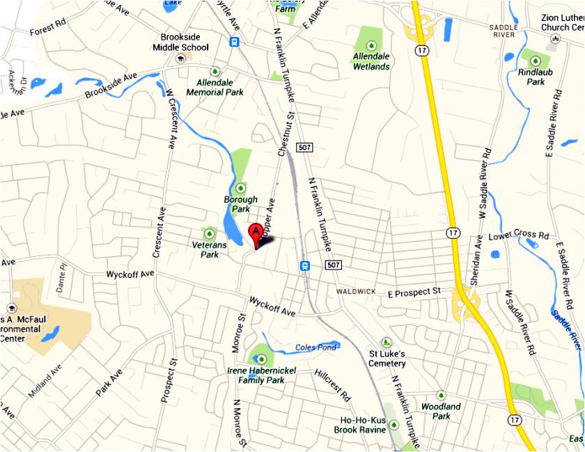 From the north on Route 17: Waldwick/Ho-Ho-Kus exit (Sherman Ave./Prospect Street) onto Prospect Street. At next light, turn left onto Franklin Turnpike, then a block later, at the next light, right onto Wyckoff Avenue. After first light, turn right onto Hopper Avenue. The parking lot is on your left after West Prospect Street. (Note: Prospect Street does not cross the rail line, use Wyckoff Ave overpass.) From Ridgewood: Maple Avenue north into downtown Ho-Ho-Kus, where it becomes (more or less) Franklin Turnpike. Go past the Hermitage to Wyckoff Avenue (traffic light). Turn left. After first light, turn right onto Hopper Avenue. The parking lot is on your left after West Prospect Street. (Note: Prospect Street does not cross the rail line.) From Allendale: Go south on Franklin Turnpike. After Orchard Street light, bear right onto Chestnut Street. Chestnut Street becomes Hopper Avenue in Waldwick. The parking lot is on your right accorss from the Waldwick pool. 100 West Ridgewood Avenue, Paramus, NJ 07652 Click here for Directions
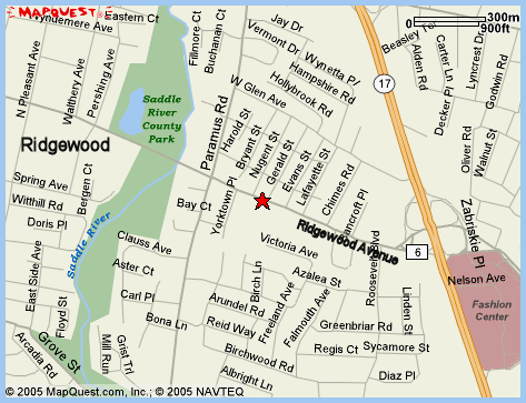
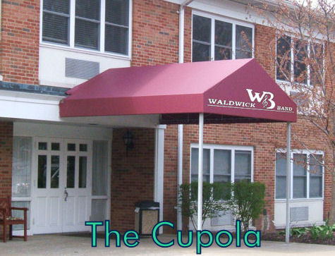
From Ridgewood: Go east on Ridgewood Avenue toward Paramus. Go through the traffic light at Paramus Road (assuming it's green). Stony Lane School is on your right, and The Cupola is right after it. The entrance with the maroon awning (see photo) is closest to The Georgian Room where we rehearse. From Oradell: Oradell Avenue becomes Ridgewood Avenue just before the Garden State Parkway. Go over the Parkway, go over Route 17, follow the directions for Route 17 above. 380 West Crescent Avenue, Allendale, NJ 07401, about 1 mile north of the Crescent Avenue Elementary School in Waldwick Click here for Directions NOTE! Band members can drive into the park but you cannot leave the park until after the fireworks are over and most of the pedestrians have left. Plan on staying 25-30 minutes after the fireworks end. If you don't wish to stay you may park across the street from the park entrance in the "first responders" parking lot next to the ball fields but you will need to print out a parking pass sent to all band members on our group email list. 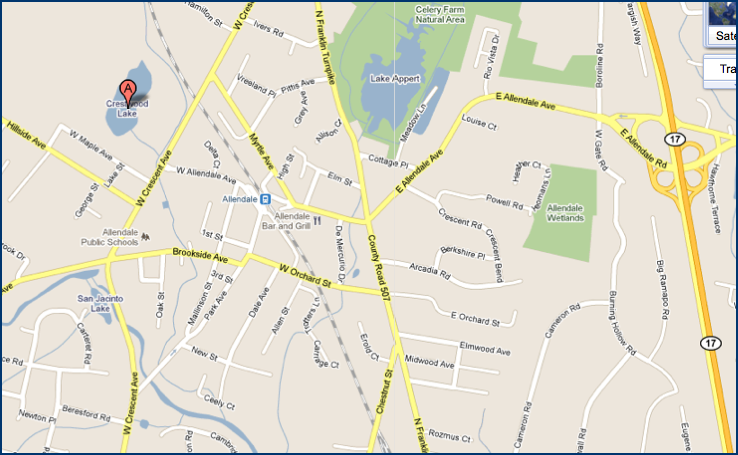 The River Vale Amphitheater is located at the rear of the property at 412 Rivervale Road, River Vale, NJ at the field below the River Vale Public Library Click here for Directions 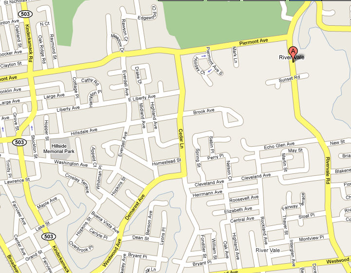 From the south on Kinderkamack Road: Head north to Hillsdale, turn right at the light onto Piermont Avenue (after Pascack Valley H.S.). Go to end, turn right onto Rivervale Road. Go 200 yards, turn left into the Town Hall complex (406 Rivervale Road). Park by the Library (the arrow on the map above). Walk down the hill to the amphitheater. From The Cupola: East on Ridgewood Avenue over Route 17. Turn left onto Pascack Road (traffic light). Turn right onto Hillsdale Avenue at that traffic light. Go 2 miles through the center of town to Kinderkamack Road; turn left onto Kinderkamack, then right onto Piermont Avenue and follow the directions above. Kinder, gentler alternate from The Cupola: Go west on Ridgewood Avenue half a block to Paramus Road (Commerce Bank); turn right onto Paramus Road. Go over 17, past the exit onto 17 North, and immediately after it is Glen Avenue; turn right. The second light is Pascack Road, and this light has a left-turn arrow! (which the lights at Ridgewood & Pascack and Linwood & Pascack do not have). Go to Hillsdale Avenue, and follow the directions above. 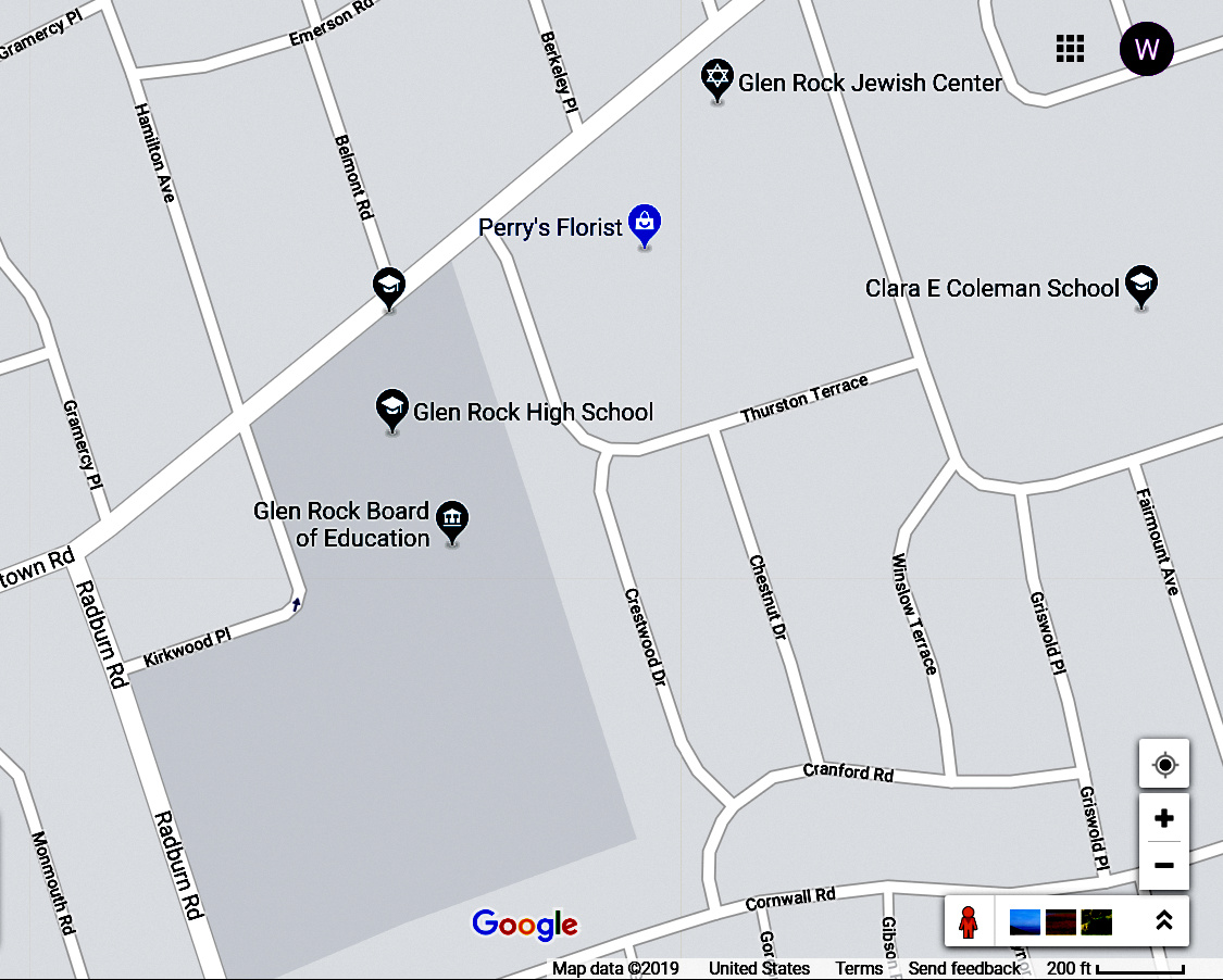 July
4th
Parades July
4th
ParadesMusicians: Meet at 9 a.m. at Glen Rock High School, at 403 Hamilton Ave in Glen Rock. Click here for directions (note: there may be a foot race on Harristown Road scheduled at 9:00 and the police will not let you drive across the road. Suggest you approach location from Fairlawn using Radburn Road) As soon as the Glen Rock parade is over, the band wagon will go directly to Ridgewood. Once the Ridgewood parade is over, the band wagon will return to Glen Rock High School Ridgefield Park McGowan Park, located at 151 Bergen Turnpike, Ridgefield Park, NJ 07660 Click here for directions
Take Teaneck
Road (also
known further north as
LaFayette Road, Schraalenburgh Road, and Washington Street) south to
its end.
(You can pick it up from Route 4, I-80, US46, or most of the area's other east-west routes). At the end of Teaneck Road, turn right onto Bergen Turnpike. Go 3-4 blocks, and McGowan Park is on your right. Use street parking; there's none at the park. Aerial view, band shell is in upper left corner: 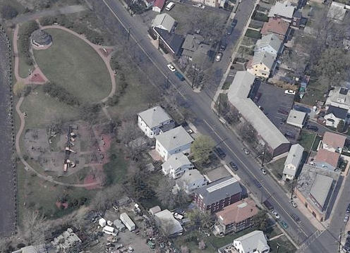 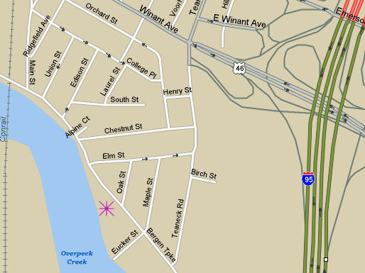 Ridgefield Park, NJ Civic Center 159 Park Ave, Ridgefield Park, NJ 07660 The Civic Center is 1 1/2 blocks west of Teaneck Road Click here for Google map directions 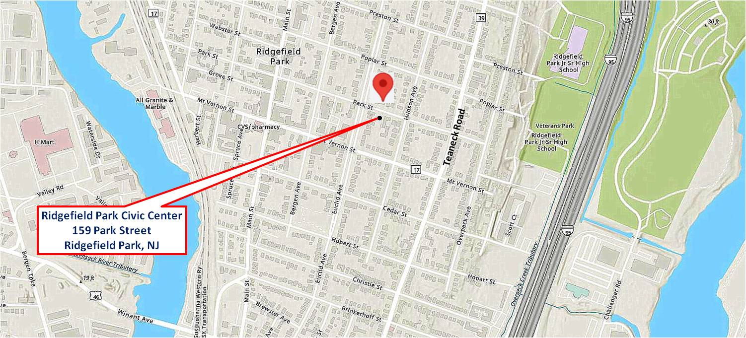 Closter Lions Bandshell at Memorial Park, Closter, NJ 72 Closter Dock Road, Closter, NJ 07624 Click here for directions NOTE!!! We do not play our concert on the Closter fireworks night, so the small parking lot at 72 Closter Dock Road in Closter next to the band shell offers ample parking. 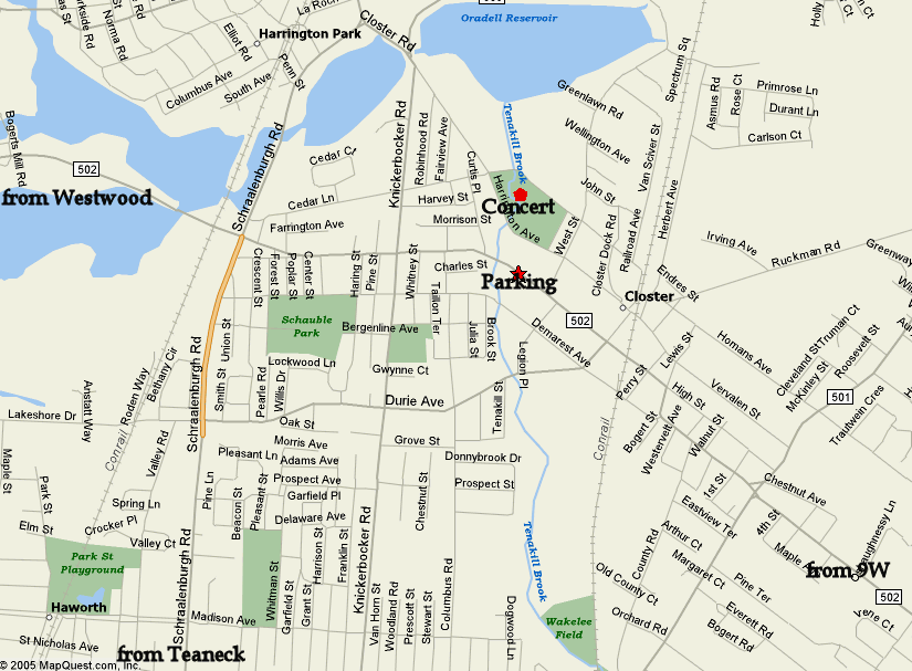 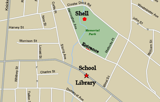 Church of the Savior-Lutheran 643 Forest Avenue, Paramus Opposite Bergen Catholic High School Click here for directions 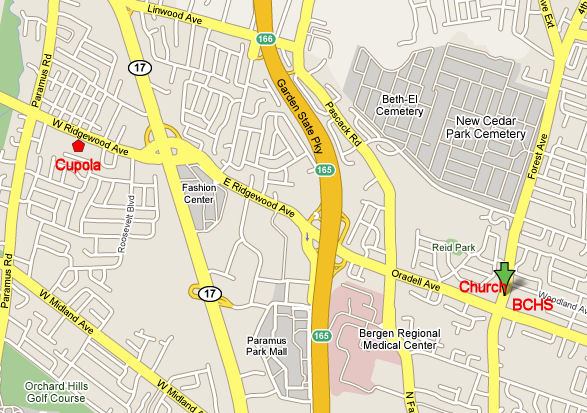 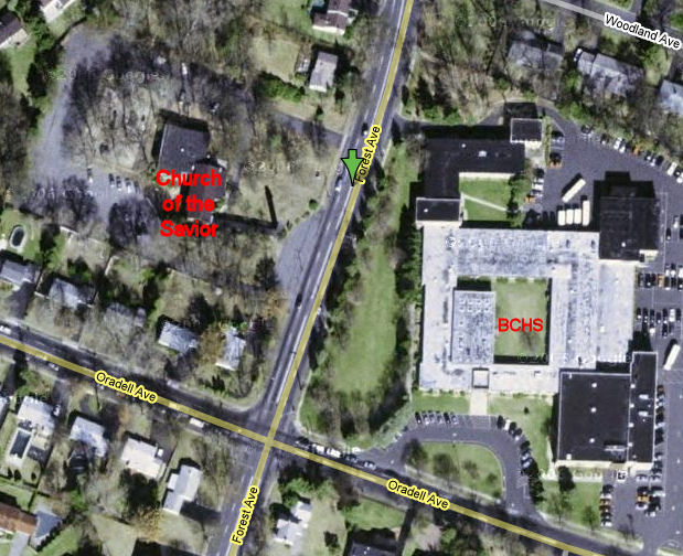
Veterans Park
Corner of Broadway and Hillsdale Ave 143 Broadway, Hillsdale, NJ Click here for directions 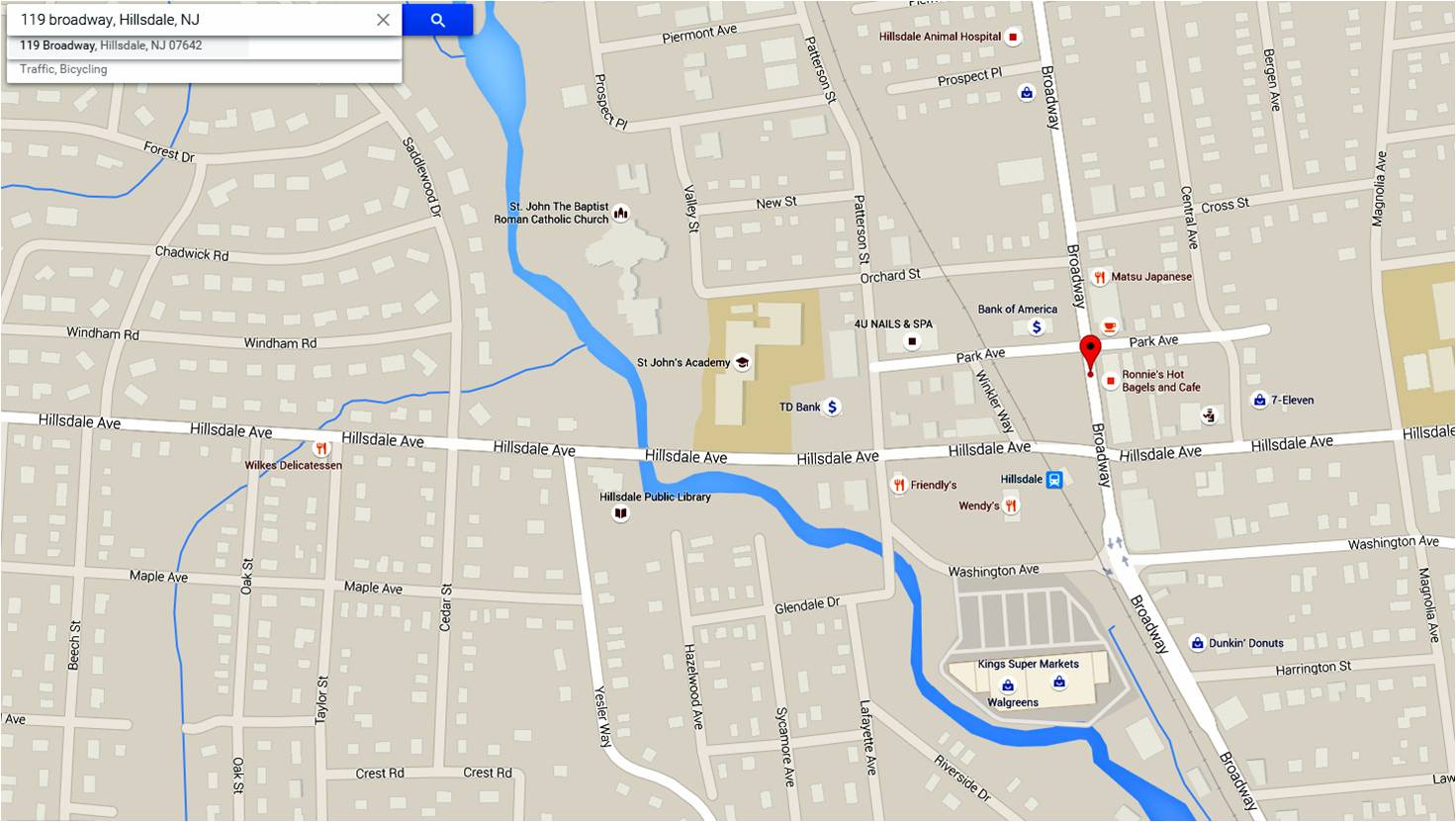 Waldwick's Borough Park 217 Pine Street Waldwick, NJ 07463 Borough Park is reached via Pennington Street, which is off of Hopper Ave. Hopper Ave. runs between Franklin Turnpike (where its name changes to Chestnut street ) and Wyckoff Ave. Click here to get Driving Directions 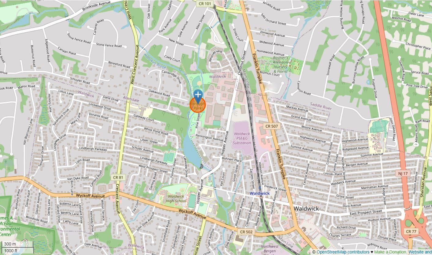 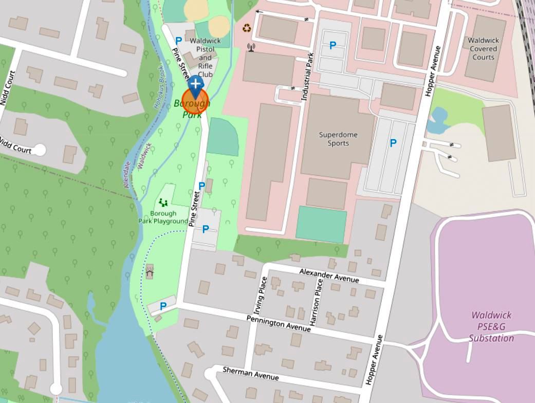 Unitarian Society of Ridgewood 113 Cottage Place: : Ridgewood, NJ 07450 Click here for Directions 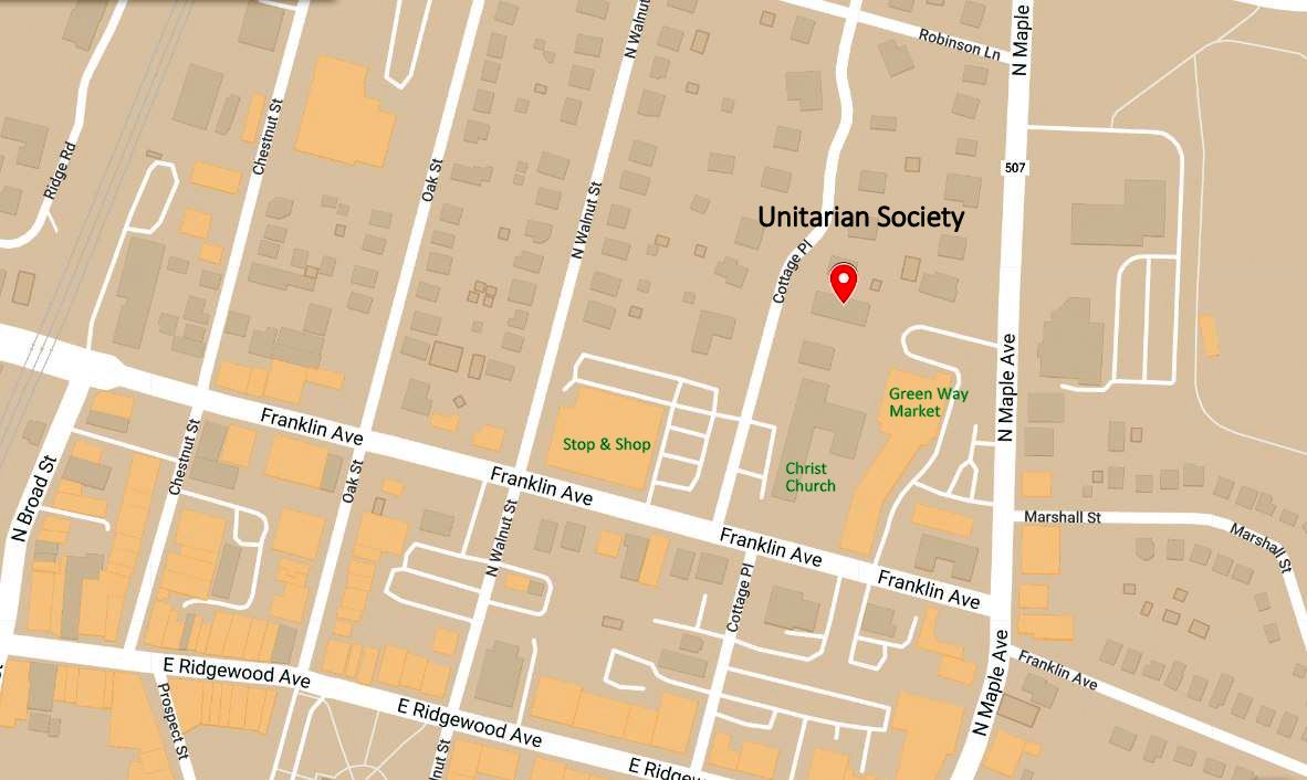 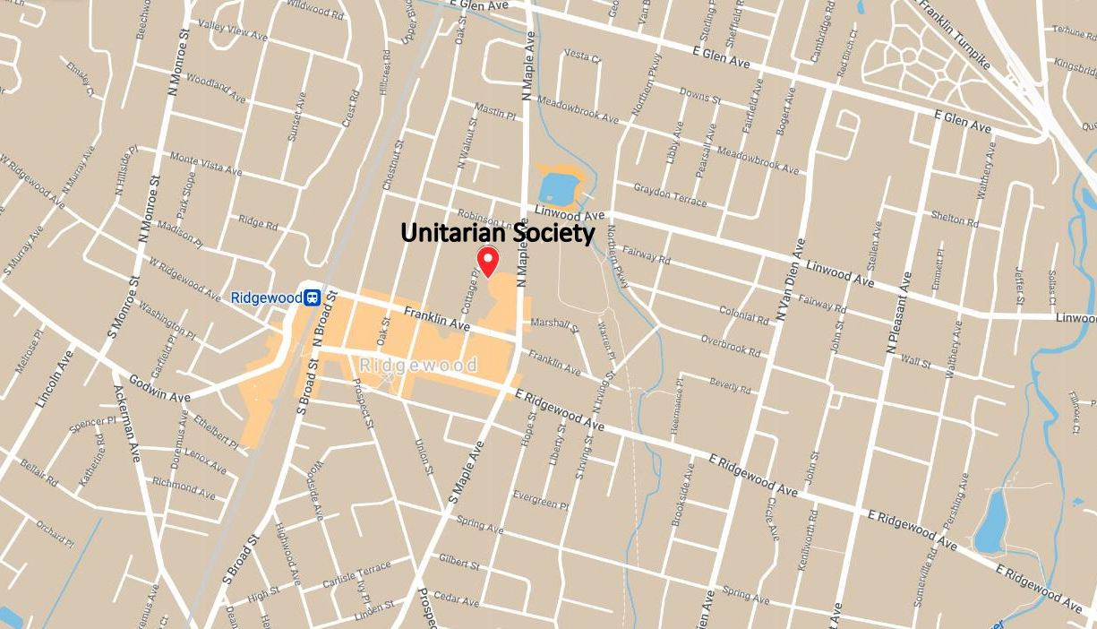 Home Performances Calendar Directions Rehearsals About the Band Gallery Donations Contact Us ©2025 The Community Band of Waldwick A 501(c)(3) not-for-profit organization Updated 9-1-2025 |
 >
>